
Population density of Hasselt
Reference date: 2026-01-01
665.2
residents/km²
Hasselt recorded 665.2 residents per km² in 2026, ranking 133rd among Belgium's municipalities by population density.


- Population
- 90,914residents
- Rank in Belgium
- 133rdout of 565 municipalities
- Density change
- +4.8
- Reference date
- 2026-01-01
Population density
Inside the municipality
Population is unevenly distributed. The view below uses exact 2025 statistical-sector boundaries and never assigns residents to an unknown polygon.100.0% of residents are located to a statistical sector; 29 remain available only in the municipality total.
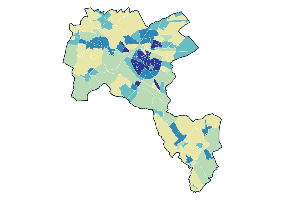
- 0 residents
- 2.8–83.4 residents/km²
- 94.1–495.3 residents/km²
- 515.1–1,467.7 residents/km²
- 1,489.2–3,209.4 residents/km²
- 3,600.1–8,448.3 residents/km²
View the exact data table
| KATARINA-WEST (sector) 71022A11K | 1,337 | 8,448.3 residents/km² |
|---|---|---|
| RUNKST - SINT-HUBERTUS (sector) 71022A30K | 3,537 | 8,427.2 residents/km² |
| HEILIG HART (sector) 71022A40K | 2,046 | 8,006.2 residents/km² |
| VLINDERSTRAAT (sector) 71022A04K | 2,135 | 7,258.8 residents/km² |
| HASSELT-CENTRUM-WEST (sector) 71022A052 | 1,564 | 7,172.4 residents/km² |
Official time series
Source: official Statbel data · Statbel
View the exact data table
| 2026 | 90,914 | 665.2 |
| 2025 | 90,249 | 660.3 |
Key figures
Use these population patterns in Horizon Mapper for catchment and location-opportunity analysis. Horizon Mapper