
Population density of Lint
Reference date: 2026-01-01
1,516.3
residents/km²
Lint recorded 1,516.3 residents per km² in 2026, ranking 43rd among Belgium's municipalities by population density.


- Population
- 8,568residents
- Rank in Belgium
- 43rdout of 565 municipalities
- Density change
- +12.2
- Reference date
- 2026-01-01
Population density
Inside the municipality
Population is unevenly distributed. The view below uses exact 2025 statistical-sector boundaries and never assigns residents to an unknown polygon.100.0% of residents are located to a statistical sector; 0 remain available only in the municipality total.
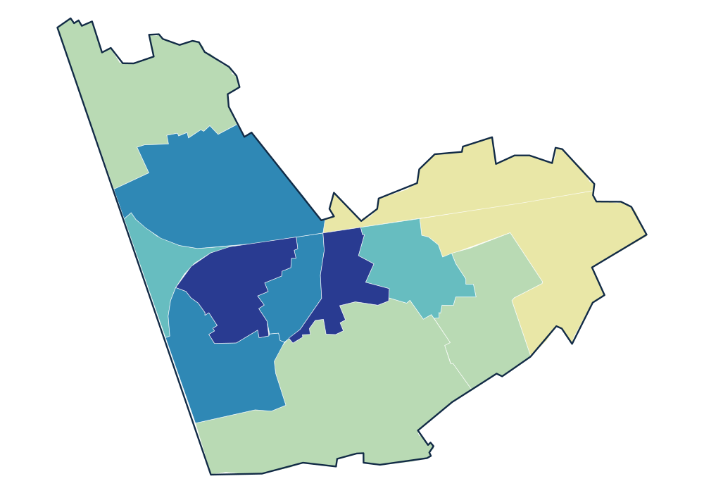
- 0 residents
- 93.0–119.7 residents/km²
- 191.2–1,311.0 residents/km²
- 1,701.8–2,015.6 residents/km²
- 2,604.6–4,072.5 residents/km²
- 4,288.5–4,533.9 residents/km²
View the exact data table
| KASTEELPARK 11025A01K | 1,389 | 4,533.9 residents/km² |
|---|---|---|
| LINT-CENTRUM-OOST 11025A00L | 825 | 4,288.5 residents/km² |
| LINT-CENTRUM-WEST 11025A00K | 718 | 4,072.5 residents/km² |
| MOEDERHOEFSTRAAT 11025A04K | 1,037 | 2,605.8 residents/km² |
| LINT-MOLEN 11025A02K | 1,896 | 2,604.6 residents/km² |
Official time series
Source: official Statbel data · Statbel
View the exact data table
| 2026 | 8,568 | 1,516.3 |
| 2025 | 8,499 | 1,504.1 |
| 2024 | 8,505 | 1,505.1 |
| 2023 | 8,548 | 1,512.8 |
| 2022 | 8,553 | 1,513.6 |
| 2021 | 8,575 | 1,517.5 |
| 2020 | 8,641 | 1,529.4 |
| 2019 | 8,718 | 1,542.6 |
| 2018 | 8,787 | 1,554.5 |
| 2017 | 8,781 | 1,570.5 |
| 2016 | 8,821 | 1,577.6 |
| 2015 | 8,767 | 1,567.9 |
| 2014 | 8,752 | 1,565.3 |
| 2013 | 8,668 | 1,550.2 |
| 2012 | 8,620 | 1,541.7 |
| 2011 | 8,522 | 1,524.1 |
| 2010 | 8,363 | 1,495.7 |
| 2009 | 8,229 | 1,471.7 |
Key figures
Use these population patterns in Horizon Mapper for catchment and location-opportunity analysis. Horizon Mapper