
Population density of Ostend
Reference date: 2026-01-01
1,769.2
residents/km²
Ostend recorded 1,769.2 residents per km² in 2026, ranking 36th among Belgium's municipalities by population density.


- Population
- 73,000residents
- Rank in Belgium
- 36thout of 565 municipalities
- Density change
- +4.4
- Reference date
- 2026-01-01
Population density
Inside the municipality
Population is unevenly distributed. The view below uses exact 2025 statistical-sector boundaries and never assigns residents to an unknown polygon.99.9% of residents are located to a statistical sector; 41 remain available only in the municipality total.
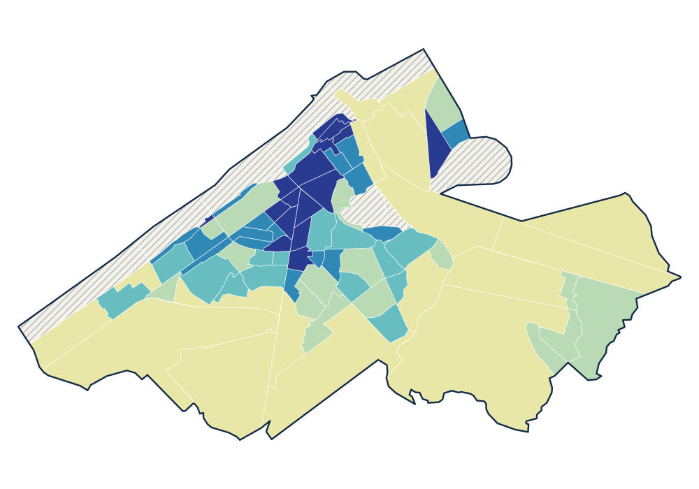
- 0 residents
- 3.7–399.8 residents/km²
- 725.5–3,044.6 residents/km²
- 3,618.7–7,682.9 residents/km²
- 8,103.4–10,900.1 residents/km²
- 10,941.4–15,621.0 residents/km²
View the exact data table
| NIEUWLANDSTRAAT 35013A42- | 2,030 | 15,621.0 residents/km² |
|---|---|---|
| A. BUYLSTRAAT 35013A02- | 1,185 | 15,565.3 residents/km² |
| DUIVENHOK-METSELAARSTRAAT 35013A50L | 1,276 | 14,361.7 residents/km² |
| HONORÉ BORGERS-GELIJKHEIDSTRAAT 35013A52M | 1,336 | 14,210.2 residents/km² |
| LANGESTRAAT 35013A03- | 1,294 | 14,030.7 residents/km² |
Official time series
Source: official Statbel data · Statbel
View the exact data table
| 2026 | 73,000 | 1,769.2 |
| 2025 | 72,817 | 1,764.8 |
| 2024 | 72,586 | 1,772.4 |
| 2023 | 72,175 | 1,762.3 |
| 2022 | 71,557 | 1,747.2 |
| 2021 | 71,755 | 1,752.1 |
| 2020 | 71,647 | 1,749.5 |
| 2019 | 71,494 | 1,745.8 |
| 2018 | 71,332 | 1,741.6 |
| 2017 | 70,994 | 1,880.1 |
| 2016 | 70,600 | 1,869.6 |
| 2015 | 70,460 | 1,865.9 |
| 2014 | 70,274 | 1,861.0 |
| 2013 | 69,969 | 1,852.9 |
| 2012 | 70,284 | 1,861.3 |
| 2011 | 69,733 | 1,846.7 |
| 2010 | 69,064 | 1,829.0 |
| 2009 | 69,061 | 1,828.9 |
Key figures
Use these population patterns in Horizon Mapper for catchment and location-opportunity analysis. Horizon Mapper