
Population density of Saint-Vith
Reference date: 2026-01-01
69.3
residents/km²
Saint-Vith recorded 69.3 residents per km² in 2026, ranking 508th among Belgium's municipalities by population density.

.jpg)
- Population
- 10,191residents
- Rank in Belgium
- 508thout of 565 municipalities
- Density change
- +0.1
- Reference date
- 2026-01-01
Population density
Inside the municipality
Population is unevenly distributed. The view below uses exact 2025 statistical-sector boundaries and never assigns residents to an unknown polygon.100.0% of residents are located to a statistical sector; 3 remain available only in the municipality total.
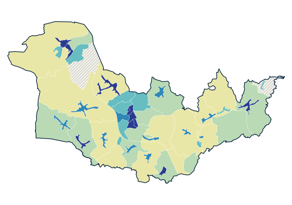
- 0 residents
- 1.0–15.9 residents/km²
- 17.6–107.1 residents/km²
- 116.7–384.8 residents/km²
- 457.7–648.1 residents/km²
- 727.8–4,940.6 residents/km²
View the exact data table
| LAURIAN-MORISSTRASSE 63067A05K | 228 | 4,940.6 residents/km² |
|---|---|---|
| SANKT-VITH-ZENTRUM 63067A00K | 1,206 | 3,488.4 residents/km² |
| ZENTRUM OST - PRUMERSTRASSE- WIESENBACHSTRASSE 63067A02K | 314 | 1,665.8 residents/km² |
| ZENTRUM NORD 63067A07K | 306 | 1,120.9 residents/km² |
| RECHT-ZENTRUM 63067F00K | 450 | 1,039.1 residents/km² |
Official time series
Source: official Statbel data · Statbel
View the exact data table
| 2026 | 10,191 | 69.3 |
| 2025 | 10,180 | 69.2 |
| 2024 | 10,071 | 68.4 |
| 2023 | 10,035 | 68.2 |
| 2022 | 9,966 | 67.7 |
| 2021 | 9,853 | 67.0 |
| 2020 | 9,779 | 66.5 |
| 2019 | 9,722 | 66.1 |
| 2018 | 9,682 | 65.8 |
| 2017 | 9,661 | 65.6 |
| 2016 | 9,637 | 65.5 |
| 2015 | 9,553 | 64.9 |
| 2014 | 9,530 | 64.8 |
| 2013 | 9,479 | 64.4 |
| 2012 | 9,451 | 64.2 |
| 2011 | 9,376 | 63.7 |
| 2010 | 9,302 | 63.2 |
| 2009 | 9,275 | 63.0 |
Key figures
Use these population patterns in Horizon Mapper for catchment and location-opportunity analysis. Horizon Mapper